Tuesday, 24 February 2015
Saturday, 21 February 2015
Friday, 2 January 2015
Hoxne Weir
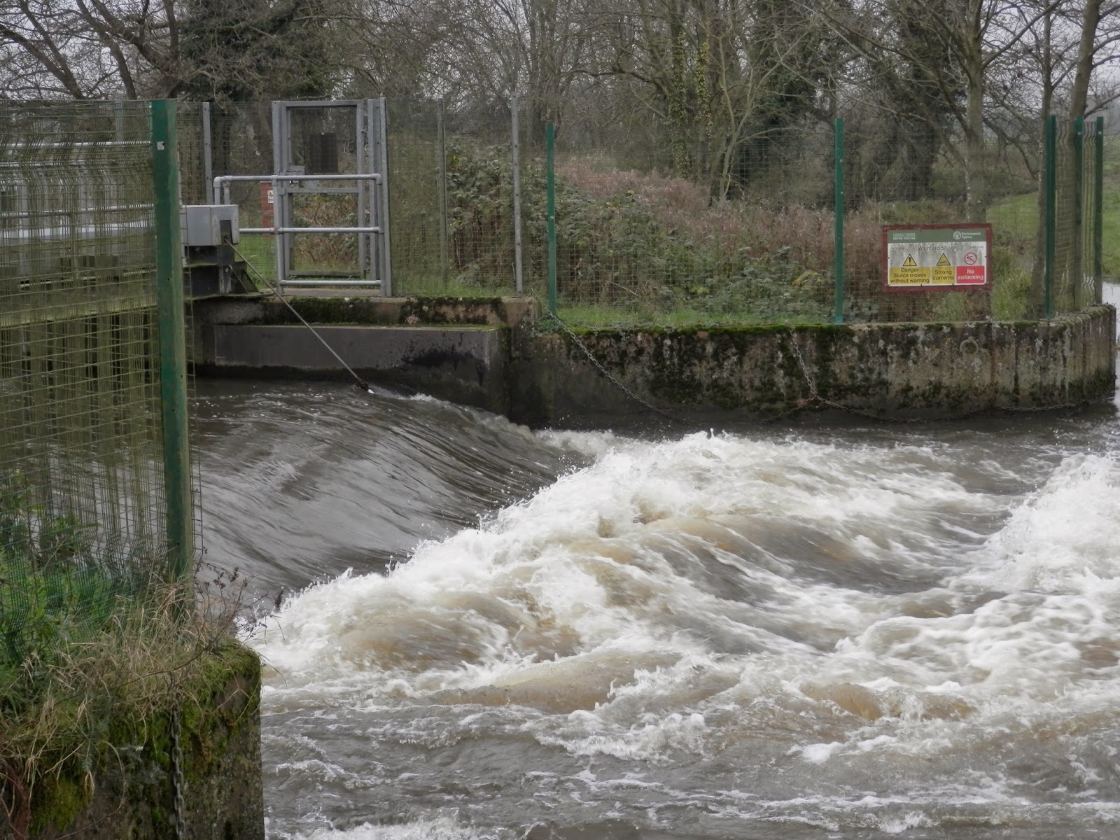
After Billingford we walked down to the weir at Hoxne. It's a simple water slide with 0.44m on the height gauge in this picture.
Probably about 4-5 foot, probably quite fast by the time you reach the bottom if there is a decent amount of water on the face.
The flow control weir looks to be marked as a sluice just upstream of the mill across the water meadows.
Probably about 4-5 foot, probably quite fast by the time you reach the bottom if there is a decent amount of water on the face.
The flow control weir looks to be marked as a sluice just upstream of the mill across the water meadows.
Billingford
Hazel and I visited the depth gauge at Billingford today. The Environment Agency web site says 0.44m for the water height above the flow weir.
It's true!
It's a simple rhs shoot at this level of water flow:
Of course you have to have a quick look at the windmill on the common:
It's true!
It's a simple rhs shoot at this level of water flow:
Of course you have to have a quick look at the windmill on the common:
Monday, 29 December 2014
Saturday, 29 November 2014
Wainford Mill sluice with playboating water flow
Wainford Mill at a nice play boating level, around 0.5 m on the Billingford height gauge.
Sometimes the wave is black
Sometimes the wave is white
PB290196wainford from Petro Dobromylskyj on Vimeo.
Sometimes the wave is black
Sometimes the wave is white
PB290196wainford from Petro Dobromylskyj on Vimeo.
Sunday, 9 November 2014
Walberswick with a southerly gale
A very breezy walk at Walberswick, surf completely blown out but nice view to Sizewell B power station across the bay.
South pier of the harbour entrance
The entrance viewed at half ebb, spring tide with an onshore gale is not pretty
Harbour itself is very calm
Walking back up the Dunwich River to the car
South pier of the harbour entrance
The entrance viewed at half ebb, spring tide with an onshore gale is not pretty
Harbour itself is very calm
Walking back up the Dunwich River to the car
Thursday, 6 November 2014
Roaring Arch weir after a day of rain
The Billington river gauge was reading 0.34m at 04.30am this morning. Drop looks a little more paddle-able today:
Thursday, 30 October 2014
Tuesday, 23 September 2014
Sunday, 21 September 2014
Cattle in the mist
Cattle on the Haddiscoe marshes. Cropped to remove the powerlines and because I rather like the line of cattle...
Monday, 11 August 2014
Priory Windpump, St Olaves
Dusk on the footpath from the suspension bridge. Possibly one of the more over photographed wind pumps in the area.
Sunday, 10 August 2014
Angles Way past the lower end of Flixton Decoy
We all went for a walk on the Angles Way, this time past the lower end of Flixton Decoy.
Horses on the skyline of a "big" Waveney valley-edge hill.
Cattle, a very mixed bunch, on the marshes
And butterflies
and blackberries
and bridges.
This is one of the two dams at the lower end of Flixton Decoy, they support a lake over half a mile long.
A lovely place, Suffolk.
Horses on the skyline of a "big" Waveney valley-edge hill.
Cattle, a very mixed bunch, on the marshes
And butterflies
and blackberries
and bridges.
This is one of the two dams at the lower end of Flixton Decoy, they support a lake over half a mile long.
A lovely place, Suffolk.
Saturday, 9 August 2014
Great Yarmouth Beach
Sea Holly on the scrubland between the power station and the Pleasure Beach, yesterday.
There was an onshore breeze and some interesting weather on the way, so the beach was deserted.
Never the less, much fun was had with sand castles.
Peter
There was an onshore breeze and some interesting weather on the way, so the beach was deserted.
Never the less, much fun was had with sand castles.
Peter
Thursday, 17 July 2014
Comma Butterfly
Comma on the apple tree. Had to wait quite a long time with the camera in hand for it to open its wings!
Monday, 14 July 2014
Subscribe to:
Posts (Atom)